Resources
Flood risk reduction and other related documents have been included below for reference. In addition, helpful website links are provided.
The Maryland Coastal Flood Explorer
The Maryland Coastal Flood Explorer s a valuable tool for visualizing predicted flood levels in Maryland’s coastal zone. Click the Cambridge Tide Station to start viewing historic flood events, high tide flooding, and projected sea level rise for Cambridge.

MDOT SHA Climate Change Vulnerability Viewer (CCVV)
MDOT SHA Climate Change Vulnerability App is an ArcGIS Online (AGOL) web application which showcases geospatial data products related to climate change and the potential impact to the State of Maryland's transportation infrastructure.
A YouTube video to assist community members in the use of the Maryland Department of Transportation (MDOT) SHA Climate Change Vulnerability Viewer was developed. This video serves as a short guide for Cambridge community members in the use of this flood risk communication online tool.

The Nature Conservancy 's
Community Incentives for Nature-Based Flood Solutions
A Guide to FEMA’s Community Rating System for Conservation Practitioners
The Nature Conservancy (TNC) seeks to foster collaboration among natural resource, floodplain, public works and hazard mitigation managers across the United States to mainstream the use of nature-based solutions to improve FEMA CRS Classifications. There are four main ways the conservation community can advance the use of nature-based solutions via the CRS Program:
-
Increasing communities’ participation in the CRS
-
Helping communities earn credit for existing
-
Planning and developing projects that count for CRS points
-
Providing science and decision support tools for CRS

Click the button below to learn more.
Federal Emergency Management Agency (FEMA)
Coastal Hazards & Flood Mapping - A Visual Guide
Coastal communities are special places and home to important resources. But what makes them so distinctive is also what makes them at high risk for floods. Floods are the nation’s costliest natural disasters, and coastal communities face many flood risks. These include storm surges, powerful waves, and erosion — all of which can cause extensive damage to homes, businesses, and public spaces.
When a coastal storm approaches, community leaders and members of the media may use technical terms to describe storm-related risks. This visual guide explains these terms and how they relate to information shown on flood maps.

Click the button below to learn more.
Cambridge Waterfront Development, Inc. (CWDI)
Cambridge Waterfront 2021Community Survey + Response Presentation
Cambridge Waterfront Development, Inc. (CWDI) strongly feels that community engagement is a critically important aspect of this redevelopment planning effort from spanning Sailwinds Park proper towards the Cambridge Creek bridge. In collaboration with BCT Design Group, a presentation video and associated survey questions were hosted on a webpage for a period of 6 weeks, between December 2020 – January 2021. During that time, nearly 1,500 individual online form responses were received. CWDI compiled and reviewed all of those responses across the five (5) “Site Planning” Topics and those results are summarily presented within this report document.

Click the button below to learn more.
ShoreRivers
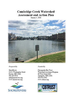
2018 Cambridge Creek Watershed Assessment and Action Plan
The purpose of this plan is to provide guidance on the restoration of the Cambridge Creek Watershed. The Cambridge Creek Watershed Assessment and Action Plan outlines a series of recommendations for watershed restoration, describes management strategies, and identifies priority projects for implementation. Planning level cost estimates are provided, where feasible, and a preliminary schedule for implementation by 2025 is outlined. Financial and technical partners for plan implementation are suggested for various recommendations and projects. The watershed plan is intended to assist ShoreRivers, the City of Cambridge, Dorchester County, and the members of the Cambridge Clean Water Advisory Committee in moving forward with restoration of the Cambridge Creek Watershed.

Click the button below to learn more.
City of Cambridge
2015 Floodplain Ordinance Update
The Federal Emergency Management Agency has identified special flood hazard areas within the boundaries of the City of Cambridge. Special flood hazard areas are subject to periodic inundation which may result in loss of life and property, health and safety hazards, disruption of commerce and governmental services, extraordinary public expenditures for flood protection and relief, and impairment of the tax base, all of which adversely affect the public health, safety and general welfare. Structures that are inadequately elevated, improperly floodproofed, or otherwise unprotected from flood damage also contribute to flood losses.
The City of Cambridge, by resolution, agreed to meet the requirements of the National Flood Insurance Program and was accepted for participation in the program on January 16, 1981. As of that date, the initial effective date of the City of Cambridge Flood Insurance Rate Map, all development and new construction as defined herein, are to be compliant with these regulations.

Click the button below to learn more.
Dorchester County
2018 Historic & Cultural Resources Hazard Mitigation & Risk Plan
Hazard mitigation planning is the process of determining how to reduce or eliminate the loss of life and property damage resulting from natural and manmade hazards. The importance of integrating historic property and cultural resource considerations into hazard mitigation planning due to the potentially devastating effects of disasters, specifically those related to flooding are evident. Oftentimes our historic and cultural resources are irreplaceable and may be lost forever following a disaster event if we do not take action to protect these vital community resources. In fact, historic properties and cultural resources are valuable economic assets that increase property values and attract businesses and tourism. Preservation and mitigation of these important resources are integral to the vitality, sense of place, and economic development of Dorchester County.

Click the button below to learn more.
Dorchester County
2022 All-Hazard Mitigation Plan
The All-Hazard Mitigation Plan forms the foundation for Dorchester County and its municipalities' long-term strategy to reduce disaster losses and break the cycle of disaster damage, reconstruction, and repeated damage. The purpose of this plan is to identify, plan, and implement cost-effective hazard mitigation measures through a comprehensive approach known as hazard mitigation planning. The Federal Emergency Management Agency (FEMA) requires hazard mitigation plans to be updated every five years. To that end, Dorchester County and its nine municipalities present the 2022 Dorchester County Hazard Mitigation Plan Update.
The 2022 Dorchester County All-Hazards Mitigation Plan is an update of the previous plan document approved by FEMA and adopted by the County in 2017. In addition, the City of Cambridge and the Towns of Brookview, Church Creek, East New Market, Eldorado, Galestown, Hurlock, Secretary, and Vienna adopted the plan.

Click the button below to learn more.
Dorchester County
2022 Flood Mitigation Plan
The purpose of a Flood Mitigation Plan is to assist State and local governments in funding cost effective actions that reduce or eliminate the long-term risk of flood damage to buildings, manufactured homes, and other insured structures. The 2022 Dorchester County Flood Mitigation Plan has been developed in conjunction with the Hazard Mitigation Plan (HMP) Update completed in September of 2022. While the HMP update process included both coastal hazards and flood chapters, along with flood-related mitigation strategies, the intent of the FMP is not to duplicate the information within the HMP. The Flood Mitigation Plan compliments and expands upon the HMP and includes tidal nuisance flooding. The FMP further develops and refines flood mitigation data, analysis, and mitigation strategies. The Flood Mitigation Plan (FMP) will articulate a comprehensive strategy for implementing technically feasible flood mitigation activities for the area affected by the plan.

Click the button below to learn more.
Eastern Shore Land Conservancy
Dorchester County Coastal Flood Vulnerability Study
Given the topography and historical development patterns of Maryland’s Eastern Shore, the potential for damage from periodic flood events caused by coastal storms and extreme high tides is well-known. What is uncertain is the degree to which the vulnerability of Eastern Shore communities is increasing as sea levels change in the Chesapeake Bay and its tributaries. Therefore, the goal of the study was to model the potential damage to buildings and their contents from severe periodic coastal flooding events, both today and in the future using a value for predicted sea level change. This coastal flood vulnerability analysis of Dorchester County yields several important conclusions. First, given that Dorchester County has several significant sources of flood threat and given that it contains more than 16,069 improved structures, the fact that 2,713 (16.9%) are already vulnerable to the 1%-chance flood is probably a result of historical land use patterns that are particularly water-oriented, the extreme lack of ground elevation in the southern half of the county, and the impact of sea level change since the 1660’s. Second, given the potential for sea level rise in the coming decades, Dorchester County is uniquely vulnerable.
Click the button below to learn more.
State of Maryland
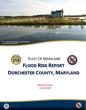
Dorchester County Flood Risk Report
This Flood Risk Report (FRR) provides non-regulatory Flood Risk information to help local or tribal officials, floodplain managers, planners, emergency managers, and others better understand their flood risk, take steps to mitigate those risks, and communicate those risks to their citizens and local businesses.
These Risk MAP products are intended to be used to assess the impacts of flooding in Dorchester County, Maryland. The analysis was performed using FEMA’s Hazus software (Version 3.1) and incorporates User Defined Facilities (UDFs) to improve the loss estimates for the 1% annual chance flood event. The UDFs were developed using local parcel, assessor, and building footprint data. The analysis also incorporates the impacts on critical facilities and expected debris and sheltering needs for the 1% annual chance flood event.

Click the button below to learn more.
